Geolocate

Kencong topographic map

Click on the map to display elevation.

About this map
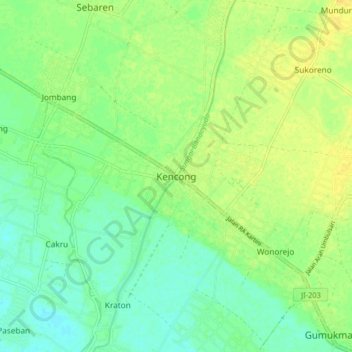
Name: Kencong topographic map, elevation, terrain.

Location: Kencong, Jember, East Java, Indonesia (-8.31382 113.32857 -8.23382 113.40857)

Average elevation: 12 m

Minimum elevation: 2 m

Maximum elevation: 22 m

Gear up for your next adventure:

🧦Outdoor Socks - Durable socks designed for hiking and outdoor sports
🧊Insulated Water Bottle - Keeps drinks cold in summer and prevents freezing in winter
🧴Waterproofing Spray - Restore the DWR coating on jackets and tents
🚲Handlebar Phone Mount - View topographic-map.com live while cycling
⛺Camping Essentials - All-in-one gear for a comfortable camping trip

As an Amazon Associate, this site earns from qualifying purchases at no extra cost to you.