Geolocate

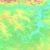
Stanyn topographic map

Click on the map to display elevation.

About this map

Name: Stanyn topographic map, elevation, terrain.

Location: Stanyn, Radekhiv Urban Hromada, Sheptytskyi Raion, Lviv Oblast, 80250, Ukraine (50.25806 24.54739 50.29806 24.58739)

Average elevation: 232 m

Minimum elevation: 218 m

Maximum elevation: 250 m

Other topographic maps

Click on a map to view its topography, its elevation and its terrain.

Gear up for your next adventure:

🥾Trekking Boots - Durable boots for long-distance trekking
🥾Waterproof Trail Shoes - Shoes designed to handle wet terrain
🥾Hiking Boots - Sturdy boots providing ankle support and traction on rugged trails
🛶Canoe Life Vest - Safety vest for water sports
🎒Hiking Daypack - Lightweight and durable backpacks for day trips and excursions

As an Amazon Associate, this site earns from qualifying purchases at no extra cost to you.