Geolocate

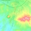
Uzunbey topographic map

Click on the map to display elevation.

About this map

Name: Uzunbey topographic map, elevation, terrain.

Location: Uzunbey, Polatlı, Ankara, Central Anatolia Region, 06900, Turkey (39.06701 31.98003 39.10701 32.02003)

Average elevation: 850 m

Minimum elevation: 809 m

Maximum elevation: 910 m

Other topographic maps

Click on a map to view its topography, its elevation and its terrain.
Şentepe Mahallesi

Turkey > Polatlı

Average elevation: 862 m

Gear up for your next adventure:

👟Trail Running Shoes - Agile footwear for fast-paced topographic exploration
🧴Sunscreen SPF - Broad-spectrum sunscreen for outdoor activities
☕Camping Coffee Maker - Brew fresh coffee anywhere on the topographic map
🪜Heavy Duty Carabiners - Multi-use clips for securing gear to your backpack
🧭GPS Tracker - Track your location in remote areas safely

As an Amazon Associate, this site earns from qualifying purchases at no extra cost to you.