Geolocate

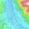
74700 topographic map

Click on the map to display elevation.

About this map

Name: 74700 topographic map, elevation, terrain.

Location: 74700, Sallanches, Bonneville, Haute-Savoie, Auvergne-Rhône-Alpes, France métropolitaine, France (45.87751 6.50945 45.98699 6.69594)

Average elevation: 1,372 m

Minimum elevation: 511 m

Maximum elevation: 2,717 m

Other topographic maps

Click on a map to view its topography, its elevation and its terrain.

Luzier

France > Auvergne-Rhône-Alpes > Haute-Savoie > Sallanches

Average elevation: 885 m

Phitherne

France > Auvergne-Rhône-Alpes > Haute-Savoie > Sallanches

Average elevation: 1,085 m

Doran

France > Auvergne-Rhône-Alpes > Haute-Savoie > Sallanches

Average elevation: 1,661 m

Fessy

France > Auvergne-Rhône-Alpes > Haute-Savoie > Sallanches

Average elevation: 729 m

Mernex

France > Auvergne-Rhône-Alpes > Haute-Savoie > Sallanches

Average elevation: 850 m

Mont Charvet

France > Auvergne-Rhône-Alpes > Haute-Savoie > Sallanches

Le mont Charvet est un sommet de la chaîne des Aravis, à 2 538 m d'altitude, dans le département de la Haute-Savoie.

Average elevation: 2,037 m

Gear up for your next adventure:

🧣Merino Neck Gaiter - Protects against wind, sun, and cold at high altitudes
🧥Fleece Jacket - Warm and lightweight jacket for layering
🥾Light Hiking Boots - Lightweight and comfortable boots for day hikes
💡Portable Camping Lamp - Rechargeable lamp for campsite lighting
🪑Ultralight Camping Stool - Compact seating for rest stops during long hikes

As an Amazon Associate, this site earns from qualifying purchases at no extra cost to you.