
Thank you for supporting this site ❤️
Make a donation
Make a donation
Gear up for your next adventure:
As an Amazon Associate, this site earns from qualifying purchases at no extra cost to you.
O Piñeiro topographic map
Click on the map to display elevation.
Thank you for supporting this site ❤️
Make a donation
Make a donation
Gear up for your next adventure:
As an Amazon Associate, this site earns from qualifying purchases at no extra cost to you.
About this map
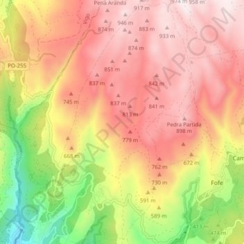
Name: O Piñeiro topographic map, elevation, terrain.
Location: O Piñeiro, Covelo, A Paradanta, Pontevedra, Galicien, Spanien (42.26777 -8.39395 42.32484 -8.34975)
Average elevation: 618 m
Minimum elevation: 123 m
Maximum elevation: 964 m
Thank you for supporting this site ❤️
Make a donation
Make a donation
Gear up for your next adventure:
As an Amazon Associate, this site earns from qualifying purchases at no extra cost to you.