Geolocate

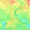
Questembert topographic map

Click on the map to display elevation.

About this map
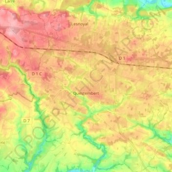
Name: Questembert topographic map, elevation, terrain.

Location: Questembert, Vannes, Morbihan, Brittany, Metropolitan France, 56230, France (47.61609 -2.50214 47.71219 -2.36756)

Average elevation: 87 m

Minimum elevation: 18 m

Maximum elevation: 142 m

Other topographic maps

Click on a map to view its topography, its elevation and its terrain.
Tréhuinec

France > Brittany > Morbihan > Vannes

Average elevation: 37 m

Comper

France > Brittany > Morbihan > Concoret

Average elevation: 116 m

Cornaud

France > Brittany > Morbihan > Saint-Gildas-de-Rhuys > Cornaud

Average elevation: 15 m

Kerflem

France > Brittany > Morbihan > Caudan

Average elevation: 33 m

Gear up for your next adventure:

🔦LED Flashlight - Powerful and long-lasting flashlight for camping and emergencies
🧢Hiking Hat - Sun-protective and breathable hats for long treks
🔥Camping Stove - Portable stoves to cook outdoors with ease
🚲Handlebar Phone Mount - View topographic-map.com live while cycling
🏃Hydration Running Vest - Carry water and maps close to your body for speed

As an Amazon Associate, this site earns from qualifying purchases at no extra cost to you.