Geolocate

Cehegín topographic map

Click on the map to display elevation.

About this map
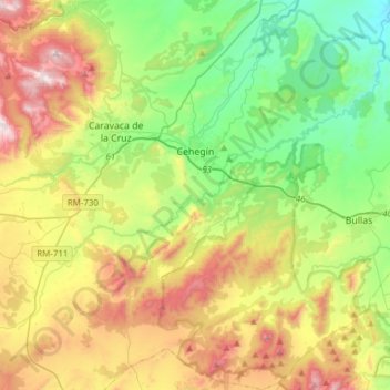
Name: Cehegín topographic map, elevation, terrain.

Location: Cehegín, Noroeste, Region of Murcia, 30430, Spain (37.94479 -1.83329 38.18584 -1.62568)

Average elevation: 724 m

Minimum elevation: 321 m

Maximum elevation: 1,410 m

Other topographic maps

Click on a map to view its topography, its elevation and its terrain.

Casas de Aledo

Spain > Region of Murcia > Noroeste > Moratalla

Average elevation: 1,205 m

Obispo

Spain > Region of Murcia > Noroeste > Moratalla

Average elevation: 1,756 m

Gear up for your next adventure:

🧦Hiking Socks - Moisture-wicking and comfortable socks for long hikes
🧥Packable Rain Jacket - Breathable waterproof layer for unpredictable weather
🥤Collapsible Travel Cup - Saves space and weight in your mess kit
🔦LED Headtorch - Bright and durable light for night activities
🧴Sunscreen SPF - Broad-spectrum sunscreen for outdoor activities

As an Amazon Associate, this site earns from qualifying purchases at no extra cost to you.