
Berryville topographic map
Click on the map to display elevation.
About this map
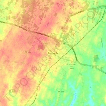
Name: Berryville topographic map, elevation, terrain.
Location: Berryville, Clarke County, Virginia, 22611, United States (39.11175 -78.02253 39.19175 -77.94253)
Average elevation: 178 m
Minimum elevation: 136 m
Maximum elevation: 208 m
Other topographic maps
Click on a map to view its topography, its elevation and its terrain.
University of Virginia Blandy Experimental Farm and Virginia State Arboretum
United States > Virginia > Clarke County > Boyce > Greenway Estates
Average elevation: 181 m