Geolocate

Katipunan topographic map

Click on the map to display elevation.

About this map

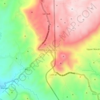
Name: Katipunan topographic map, elevation, terrain.

Location: Katipunan, Arakan, North Cotabato, Soccsksargen, Philippines (7.40237 125.21512 7.44237 125.25512)

Average elevation: 1,023 m

Minimum elevation: 767 m

Maximum elevation: 1,261 m

Gear up for your next adventure:

🕶️Polarized Sunglasses - Protect your eyes with durable polarized lenses
🧤Thermal Hiking Gloves - Grip-enhanced gloves for cold-weather altitude trekking
🥾Trekking Boots - Durable boots for long-distance trekking
🧭GPS Tracker - Track your location in remote areas safely
🔋Solar Power Bank - Keep your GPS and devices charged during long outdoor trips

As an Amazon Associate, this site earns from qualifying purchases at no extra cost to you.