
Penatanguishene Memorial Park topographic map
Interactive map
Click on the map to display elevation.
About this map
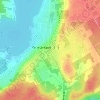
Name: Penatanguishene Memorial Park topographic map, elevation, terrain.
Average elevation: 210 m
Minimum elevation: 175 m
Maximum elevation: 250 m
Other topographic maps
Click on a map to view its topography, its elevation and its terrain.
Awenda Provincial Park
Canada > Ontario > Simcoe County > Penetanguishene
Awenda Provincial Park, Penetanguishene, Simcoe County, Central Ontario, Ontario, L9M 2G2, Canada
Average elevation: 192 m