
Make a donation
Gear up for your next adventure:
As an Amazon Associate, this site earns from qualifying purchases at no extra cost to you.
Rock topographic map
Click on the map to display elevation.
Make a donation
Gear up for your next adventure:
As an Amazon Associate, this site earns from qualifying purchases at no extra cost to you.
About this map
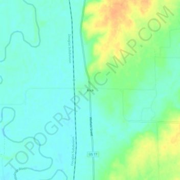
Name: Rock topographic map, elevation, terrain.
Location: Rock, Cowley County, Kansas, United States (37.42030 -97.02643 37.46030 -96.98643)
Average elevation: 362 m
Minimum elevation: 350 m
Maximum elevation: 386 m
Make a donation
Gear up for your next adventure:
As an Amazon Associate, this site earns from qualifying purchases at no extra cost to you.
Other topographic maps
Click on a map to view its topography, its elevation and its terrain.
Parkerfield
United States > Kansas > Cowley County
Parkerfield is located near the east edge of Arkansas City. The land topography consists of about 564 acres (261 acres platted and 302 acres (1.22 km2) unplatted at the time of incorporation) with basically a flat terrain with no natural boundaries and a drainage pattern generally to the southeast for the…
Average elevation: 351 m
Make a donation
Gear up for your next adventure:
As an Amazon Associate, this site earns from qualifying purchases at no extra cost to you.