Geolocate

Chefornak topographic map

Click on the map to display elevation.

About this map

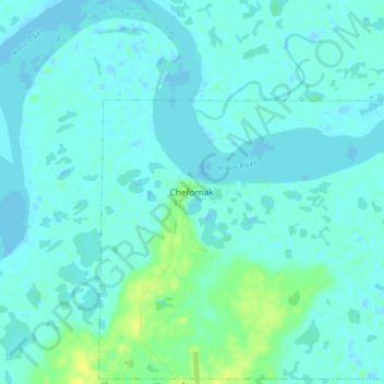
Name: Chefornak topographic map, elevation, terrain.

Location: Chefornak, Unorganized Borough, Alaska, United States (60.13838 -164.30042 60.17838 -164.26042)

Average elevation: 4 m

Minimum elevation: -8 m

Maximum elevation: 17 m

Gear up for your next adventure:

🏃Hydration Running Vest - Carry water and maps close to your body for speed
🍽️Titanium Camping Spork - Ultralight and indestructible eating utensil
🧥Thermal Fleece Jacket - Versatile insulation for changing mountain temperatures
🔪Outdoor Multitool - Versatile tool for repairs and food prep in the wild
🦯Trekking Poles - Reduced impact on joints for steep topographic climbs

As an Amazon Associate, this site earns from qualifying purchases at no extra cost to you.