Geolocate

Isla Altamura topographic map

Click on the map to display elevation.

About this map

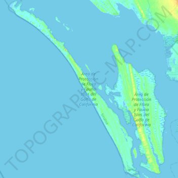
Name: Isla Altamura topographic map, elevation, terrain.

Location: Isla Altamura, Angostura, Sinaloa, Mexico (24.81508 -108.34337 25.12737 -108.08905)

Average elevation: 1 m

Minimum elevation: -5 m

Maximum elevation: 28 m

Gear up for your next adventure:

🧢Hiking Sun Hat - Wide-brimmed protection for exposed mountain ridges
🧰Survival Kit - Essential gear for emergencies in the wilderness
🥾All-Terrain Hiking Boots - Versatile boots for varied hiking conditions
🦟Insect Repellent - Keep mosquitoes and black flies away in wooded areas
🚲MTB Frame Bag - Carry tools and maps directly on your bicycle frame

As an Amazon Associate, this site earns from qualifying purchases at no extra cost to you.