Geolocate

Jamul topographic map

Click on the map to display elevation.

About this map

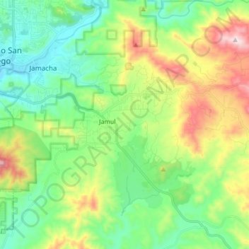
Name: Jamul topographic map, elevation, terrain.

Location: Jamul, San Diego County, California, 91935, United States (32.68454 -116.94073 32.74646 -116.80440)

Average elevation: 335 m

Minimum elevation: 97 m

Maximum elevation: 847 m

Gear up for your next adventure:

🗺️Topographic Maps - Detailed maps to explore trails, mountains, and wilderness areas
🔋Lithium AA Batteries - Long-lasting power that performs in extreme cold
💧Filtered Water Bottle - Safe drinking water on the go
🚲MTB Frame Bag - Carry tools and maps directly on your bicycle frame
🧳Compression Sacks - Maximize space in your backpack by shrinking gear

As an Amazon Associate, this site earns from qualifying purchases at no extra cost to you.