Geolocate

Dadahu topographic map

Click on the map to display elevation.

About this map

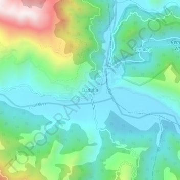
Name: Dadahu topographic map, elevation, terrain.

Location: Dadahu, Sirmaur District, Himachal Pradesh, 173022, India (30.57981 77.41579 30.61981 77.45579)

Average elevation: 827 m

Minimum elevation: 616 m

Maximum elevation: 1,461 m

Gear up for your next adventure:

🧰Multitool Knife - Compact and versatile tool for outdoor use
🧊Insulated Water Bottle - Keeps drinks cold in summer and prevents freezing in winter
🧦Hiking Socks - Moisture-wicking and comfortable socks for long hikes
🔭Compact Monocular - One-handed bird watching and trail spotting
🧥Waterproof Pants - Keep dry during rainy hiking conditions

As an Amazon Associate, this site earns from qualifying purchases at no extra cost to you.