
Thank you for supporting this site ❤️
Make a donation
Make a donation
Gear up for your next adventure:
As an Amazon Associate, this site earns from qualifying purchases at no extra cost to you.
Toclla topographic map
Click on the map to display elevation.
Thank you for supporting this site ❤️
Make a donation
Make a donation
Gear up for your next adventure:
As an Amazon Associate, this site earns from qualifying purchases at no extra cost to you.
About this map
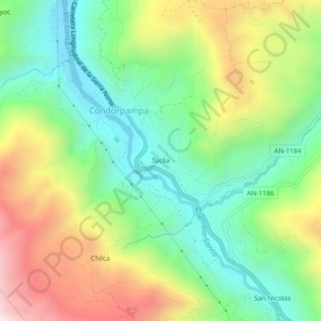
Name: Toclla topographic map, elevation, terrain.
Location: Toclla, Condorpampa, Huaraz, Áncash, 02001, Perú (-9.59777 -77.54807 -9.55777 -77.50807)
Average elevation: 3,386 m
Minimum elevation: 3,055 m
Maximum elevation: 3,914 m
Thank you for supporting this site ❤️
Make a donation
Make a donation
Gear up for your next adventure:
As an Amazon Associate, this site earns from qualifying purchases at no extra cost to you.