
Meriden topographic map
Click on the map to display elevation.
About this map
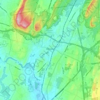
Name: Meriden topographic map, elevation, terrain.
Average elevation: 88 m
Minimum elevation: 16 m
Maximum elevation: 304 m
Other topographic maps
Click on a map to view its topography, its elevation and its terrain.
Morningside
United States > Connecticut > South Central Connecticut Planning Region > Milford
Average elevation: 5 m
Big Indian
United States > Connecticut > South Central Connecticut Planning Region > Guilford
Average elevation: 41 m