Geolocate

Mikinduri topographic map

Click on the map to display elevation.

About this map

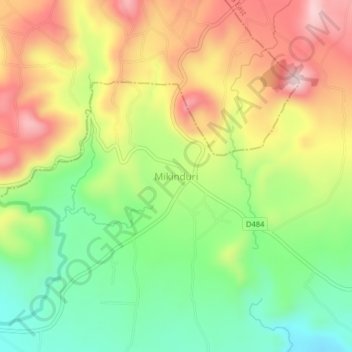
Name: Mikinduri topographic map, elevation, terrain.

Location: Mikinduri, Mikinduri ward, Tigania East, Meru County, Kenya (0.10328 37.81449 0.14328 37.85449)

Average elevation: 1,309 m

Minimum elevation: 1,147 m

Maximum elevation: 1,495 m

Gear up for your next adventure:

🦌Outdoor Trail Camera - Monitor wildlife activity near your favorite spots
🔭Compact Monocular - One-handed bird watching and trail spotting
🧰Multitool Knife - Compact and versatile tool for outdoor use
🎒Hiking Backpack - Lightweight and ergonomic backpacks for day hikes or multi-day treks
🧴Insect Repellent - Protect yourself from bugs during outdoor adventures

As an Amazon Associate, this site earns from qualifying purchases at no extra cost to you.