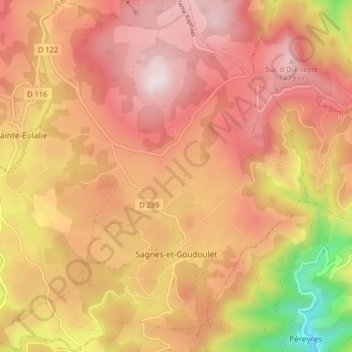
Sagnes-et-Goudoulet topographic map
Interactive map
Click on the map to display elevation.
About this map
Name: Sagnes-et-Goudoulet topographic map, elevation, terrain.
Average elevation: 1,253 m
Minimum elevation: 781 m
Maximum elevation: 1,527 m

Click on the map to display elevation.
Name: Sagnes-et-Goudoulet topographic map, elevation, terrain.
Average elevation: 1,253 m
Minimum elevation: 781 m
Maximum elevation: 1,527 m