Geolocate

Veyo topographic map

Click on the map to display elevation.

Veyo

The elevation of Veyo is 4,485 feet (1,367 m).

Wikipedia (CC-BY-SA 3.0)

About this map

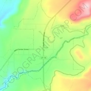
Name: Veyo topographic map, elevation, terrain.

Location: Veyo, Washington County, Utah, 84782, United States (37.32278 -113.71396 37.35571 -113.67400)

Average elevation: 1,379 m

Minimum elevation: 1,254 m

Maximum elevation: 1,545 m

Gear up for your next adventure:

🔦UV Flashlight - Detect minerals or specific insects in the dark
🥾Light Trekking Boots - Supportive boots for multi-day treks
🥾Lightweight Hiking Shoes - Comfortable shoes for day hikes
🎒Hiking Backpack - Lightweight and ergonomic backpacks for day hikes or multi-day treks
🥾Hiking Shorts - Breathable shorts suitable for summer hikes

As an Amazon Associate, this site earns from qualifying purchases at no extra cost to you.