Geolocate

Halai topographic map

Click on the map to display elevation.

About this map

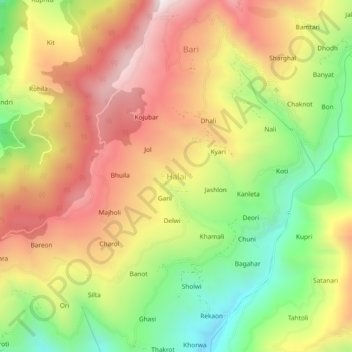
Name: Halai topographic map, elevation, terrain.

Location: Halai, Kotkhai, Shimla, Himachal Pradesh, 171204, India (31.12523 77.52398 31.16523 77.56398)

Average elevation: 2,151 m

Minimum elevation: 1,680 m

Maximum elevation: 2,602 m

Gear up for your next adventure:

👟Sport Hiking Sandals - Breathable footwear for water crossings and camp rest
🥾Mountaineering Boots - Supportive boots for climbing and high-altitude hiking
🏃Hydration Running Vest - Carry water and maps close to your body for speed
Backpacking Tent - Lightweight tent for long-distance hiking trips
🪑Insulated Seat Pad - Protect your seat from cold rocks and wet logs

As an Amazon Associate, this site earns from qualifying purchases at no extra cost to you.