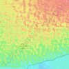
Mithi topographic map
Click on the map to display elevation.
Mithi
The town is located at 24°74'0N 69°80'0E with an altitude of 28 meters (92 feet). It lies 450 kilometers from Karachi and is located in a desert area. The geography of Mithi is characterized by its arid landscape, typical of the Thar Desert, which influences the climate, agriculture, and daily life in the town. Water scarcity is a significant issue due to the desert terrain. The region is known for its unique flora and fauna adapted to the harsh desert conditions, as well as for the traditional mud-brick architecture found in the town.
About this map

Name: Mithi topographic map, elevation, terrain.
Average elevation: 56 m
Minimum elevation: 30 m
Maximum elevation: 101 m
Other topographic maps
Click on a map to view its topography, its elevation and its terrain.