Geolocate

Walnut Mountain topographic map

Click on the map to display elevation.

About this map

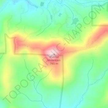
Name: Walnut Mountain topographic map, elevation, terrain.

Location: Walnut Mountain, Gilmer County, Georgia, United States (34.69781 -84.41747 34.69791 -84.41737)

Average elevation: 578 m

Minimum elevation: 461 m

Maximum elevation: 781 m

Gear up for your next adventure:

🛶Waterproof Dry Bags - Keep electronics and clothes dry during river crossings
🧤Rechargeable Heated Gloves - Extreme warmth for Canadian winter expeditions
🧴Waterproofing Spray - Restore the DWR coating on jackets and tents
🚲Bike Repair Kit - Essential tools for on-trail mechanical issues
🧤Insulated Winter Gloves - Heavy-duty protection for sub-zero Canadian adventures

As an Amazon Associate, this site earns from qualifying purchases at no extra cost to you.