Geolocate

Tivissa topographic map

Click on the map to display elevation.

About this map

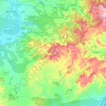
Name: Tivissa topographic map, elevation, terrain.

Location: Tivissa, Ribera d'Ebre, Tarragona, Catalonia, 43746, Spain (40.93218 0.63378 41.10504 0.87304)

Average elevation: 284 m

Minimum elevation: 0 m

Maximum elevation: 841 m

Gear up for your next adventure:

🛏️Sleeping Bag - Warm and compact sleeping bags for outdoor camping
🧥Ultralight Puffy Jacket - Maximum warmth that packs down to the size of an orange
🌬️Windproof Camp Stove - Efficient cooking even on exposed mountain peaks
🔪Outdoor Multitool - Versatile tool for repairs and food prep in the wild
🔋Solar Power Bank - Keep your GPS and devices charged during long outdoor trips

As an Amazon Associate, this site earns from qualifying purchases at no extra cost to you.