Geolocate

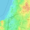
Ramat HaSharon topographic map

Click on the map to display elevation.

About this map

Name: Ramat HaSharon topographic map, elevation, terrain.

Location: Ramat HaSharon, Tel Aviv Subdistrict, Tel-Aviv District, Israel (32.12331 34.81096 32.15406 34.86569)

Average elevation: 45 m

Minimum elevation: 11 m

Maximum elevation: 89 m

Other topographic maps

Click on a map to view its topography, its elevation and its terrain.

Herzliya

Israel > Tel-Aviv District

Average elevation: 38 m

The Track Park

Israel > Tel-Aviv District > Tel Aviv

Average elevation: 15 m

Ayalon River

Israel > Tel-Aviv District > Tel Aviv

Average elevation: 23 m

Or Yehuda

Israel > Tel-Aviv District

Average elevation: 39 m

Herzliya

Israel > Tel-Aviv District

Average elevation: 38 m

Herzliya

Israel > Tel-Aviv District

Average elevation: 38 m

Gear up for your next adventure:

⛺Camping Groundsheet - Protect your tent from moisture and dirt
🧥Waterproof Jacket - Lightweight rain jackets for hiking and outdoor activities
🚲Handlebar Phone Mount - View topographic-map.com live while cycling
🥾Trekking Poles - Adjustable trekking poles to reduce knee stress and improve stability
🥾Durable Hiking Shoes - Long-lasting shoes for frequent hiking

As an Amazon Associate, this site earns from qualifying purchases at no extra cost to you.