
Lyons topographic map
Click on the map to display elevation.
About this map
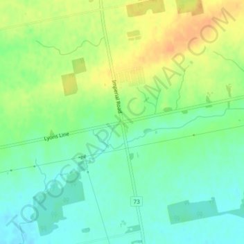
Name: Lyons topographic map, elevation, terrain.
Location: Lyons, Elgin County, Ontario, N0L 2J0, Canada (42.83733 -80.99675 42.85733 -80.97675)
Average elevation: 263 m
Minimum elevation: 248 m
Maximum elevation: 282 m
Elgin County trails, hiking, mountain biking, running and outdoor activities
Other topographic maps
Click on a map to view its topography, its elevation and its terrain.
John E. Pearce Provincial Park
Canada > Ontario > Elgin County > Dutton/Dunwich
Average elevation: 200 m