Geolocate

Kalyani topographic map

Click on the map to display elevation.

About this map

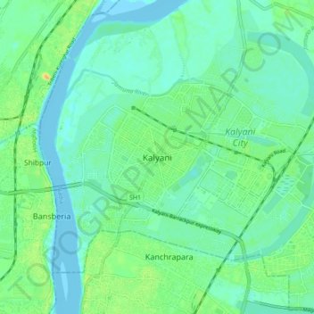
Name: Kalyani topographic map, elevation, terrain.

Location: Kalyani, Chakdah, Nadia, West Bengal, 741235, India (22.81497 88.27459 23.13497 88.59459)

Average elevation: 9 m

Minimum elevation: -3 m

Maximum elevation: 27 m

Gear up for your next adventure:

🧤Rechargeable Heated Gloves - Extreme warmth for Canadian winter expeditions
🥾Mountaineering Boots - Supportive boots for climbing and high-altitude hiking
🧊Portable Cooler - Keep food and drinks cold during outdoor adventures
🧦Merino Wool Socks - Moisture-wicking comfort for long-distance hiking
🔋Emergency Crank Radio - Weather alerts and power without needing batteries

As an Amazon Associate, this site earns from qualifying purchases at no extra cost to you.