
Plöven topographic map
Interactive map
Click on the map to display elevation.
About this map
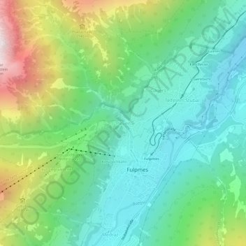
Name: Plöven topographic map, elevation, terrain.
Location: Plöven, Fulpmes, Bezirk Innsbruck-Land, 6165, Autriche (47.14063 11.32564 47.18063 11.36564)
Average elevation: 1,297 m
Minimum elevation: 836 m
Maximum elevation: 2,366 m