Geolocate

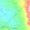
Balewangi topographic map

Click on the map to display elevation.

About this map

Name: Balewangi topographic map, elevation, terrain.

Location: Balewangi, Cisurupan, Garut, West Java, Java, Indonesia (-7.30992 107.77838 -7.29915 107.79943)

Average elevation: 1,190 m

Minimum elevation: 1,054 m

Maximum elevation: 1,334 m

Other topographic maps

Click on a map to view its topography, its elevation and its terrain.
Cisitu

Indonesia > West Java > Garut > Malangbong

Average elevation: 667 m

Mount Cikuray

Indonesia > West Java > Garut

Average elevation: 2,237 m

Gear up for your next adventure:

🏃Hydration Running Vest - Carry water and maps close to your body for speed
🧶550 Survival Paracord - Versatile utility cord for emergency repairs and rigging
🔥Camping Stove - Portable stoves to cook outdoors with ease
🛰️Satellite Messenger - Emergency communication for areas with no cell service
💡Portable Camping Lamp - Rechargeable lamp for campsite lighting

As an Amazon Associate, this site earns from qualifying purchases at no extra cost to you.