Geolocate

Castle Fin topographic map

Click on the map to display elevation.

About this map

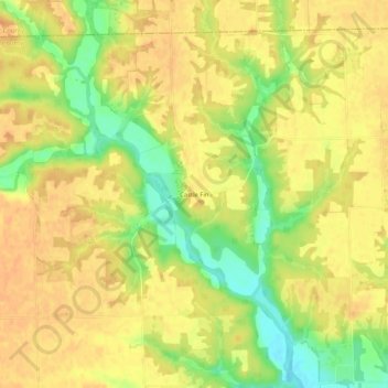
Name: Castle Fin topographic map, elevation, terrain.

Location: Castle Fin, Clark County, Illinois, United States (39.45004 -87.75336 39.49004 -87.71336)

Average elevation: 188 m

Minimum elevation: 164 m

Maximum elevation: 199 m

Other topographic maps

Click on a map to view its topography, its elevation and its terrain.

Casey

United States > Illinois > Clark County

Average elevation: 197 m

Gear up for your next adventure:

🔭Compact Monocular - One-handed bird watching and trail spotting
🛏️Sleeping Bag - Warm and compact sleeping bags for outdoor camping
🧶550 Survival Paracord - Versatile utility cord for emergency repairs and rigging
🛌Insulated Sleeping Pad - Critical thermal barrier between you and the cold ground
Camping Essentials - All-in-one gear for a comfortable camping trip

As an Amazon Associate, this site earns from qualifying purchases at no extra cost to you.