
Thank you for supporting this site ❤️
Make a donation
Make a donation
Gear up for your next adventure:
As an Amazon Associate, this site earns from qualifying purchases at no extra cost to you.
Besonrieux topographic map
Click on the map to display elevation.
Thank you for supporting this site ❤️
Make a donation
Make a donation
Gear up for your next adventure:
As an Amazon Associate, this site earns from qualifying purchases at no extra cost to you.
About this map
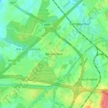
Name: Besonrieux topographic map, elevation, terrain.
Location: Besonrieux, La Louvière, Henegouwen, Wallonië, 7100, België (50.49173 4.17596 50.53173 4.21596)
Average elevation: 125 m
Minimum elevation: 106 m
Maximum elevation: 161 m
Thank you for supporting this site ❤️
Make a donation
Make a donation
Gear up for your next adventure:
As an Amazon Associate, this site earns from qualifying purchases at no extra cost to you.