
Thank you for supporting this site ❤️
Make a donation
Make a donation
Gear up for your next adventure:
As an Amazon Associate, this site earns from qualifying purchases at no extra cost to you.
Cabeços topographic map
Click on the map to display elevation.
Thank you for supporting this site ❤️
Make a donation
Make a donation
Gear up for your next adventure:
As an Amazon Associate, this site earns from qualifying purchases at no extra cost to you.
About this map
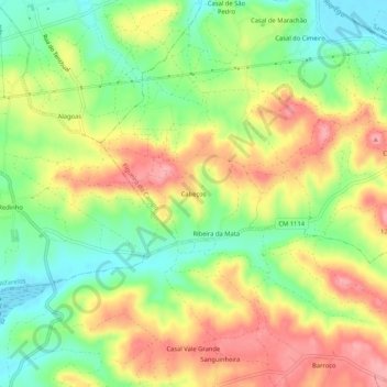
Name: Cabeços topographic map, elevation, terrain.
Location: Cabeços, Figueiró do Campo, Soure, Coimbra, 3130-080, Portugal (40.11911 -8.63243 40.15911 -8.59243)
Average elevation: 56 m
Minimum elevation: 3 m
Maximum elevation: 112 m
Thank you for supporting this site ❤️
Make a donation
Make a donation
Gear up for your next adventure:
As an Amazon Associate, this site earns from qualifying purchases at no extra cost to you.