Geolocate

Le Cosquer topographic map

Click on the map to display elevation.

About this map
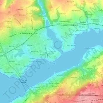
Name: Le Cosquer topographic map, elevation, terrain.

Location: Le Cosquer, Le Relecq-Kerhuon, Brest, Finistère, Bretagne, France métropolitaine, 29480, France (48.38046 -4.40296 48.42046 -4.36296)

Average elevation: 39 m

Minimum elevation: -2 m

Maximum elevation: 120 m

Other topographic maps

Click on a map to view its topography, its elevation and its terrain.

29480

France > Bretagne > Finistère > Le Relecq-Kerhuon

Average elevation: 36 m

Gear up for your next adventure:

🧢Outdoor Visor - Breathable visor for sunny hikes
💧Collapsible Water Bottle - Space-saving water bottle for outdoor activities
🔭Outdoor Binoculars - Lightweight binoculars for birdwatching and hiking
🧼Travel Hand Sanitizer - Keep hands clean when water is scarce
💧Hydration Bladder - Hands-free hydration solution for long treks

As an Amazon Associate, this site earns from qualifying purchases at no extra cost to you.