Geolocate

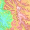
Yerne topographic map

Click on the map to display elevation.

About this map

Name: Yerne topographic map, elevation, terrain.

Location: Yerne, Jaoli, Satara, Maharashtra, 412806, India (17.85001 73.68257 17.89001 73.72257)

Average elevation: 947 m

Minimum elevation: 688 m

Maximum elevation: 1,313 m

Other topographic maps

Click on a map to view its topography, its elevation and its terrain.
ulwe

India > Maharashtra > Jaoli > Satara

Average elevation: 1,081 m

Gear up for your next adventure:

🎒Backpack Rain Cover - External shield to keep your entire pack dry
🔋Solar Power Bank - Keep your GPS and devices charged during long outdoor trips
🥾Waterproof Hiking Boots - Boots keeping your feet dry in wet conditions
🧥Ultralight Puffy Jacket - Maximum warmth that packs down to the size of an orange
🧴Waterproofing Spray - Restore the DWR coating on jackets and tents

As an Amazon Associate, this site earns from qualifying purchases at no extra cost to you.