Geolocate

Garzón topographic map

Click on the map to display elevation.

About this map

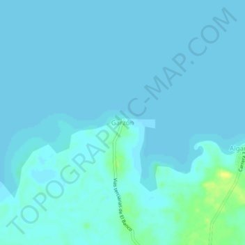
Name: Garzón topographic map, elevation, terrain.

Location: Garzón, El Banco, Magdalena, RAP Caribe, Colombia (9.11520 -74.08489 9.15520 -74.04489)

Average elevation: 21 m

Minimum elevation: 19 m

Maximum elevation: 37 m

Gear up for your next adventure:

🧢Hiking Hat - Sun-protective and breathable hats for long treks
🩹Moleskin Blister Pads - Direct protection for painful foot pressure points
🧭GPS Tracker - Track your location in remote areas safely
🧊Portable Cooler - Keep food and drinks cold during outdoor adventures
🥾Trekking Poles - Adjustable trekking poles to reduce knee stress and improve stability

As an Amazon Associate, this site earns from qualifying purchases at no extra cost to you.