
Frein topographic map
Interactive map
Click on the map to display elevation.
About this map
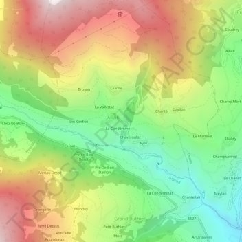
Name: Frein topographic map, elevation, terrain.
Location: Frein, Allein, Vallée d'Aoste, 11014, Italie (45.78724 7.25443 45.82724 7.29443)
Average elevation: 1,434 m
Minimum elevation: 811 m
Maximum elevation: 2,182 m