Geolocate

Panan topographic map

Click on the map to display elevation.

About this map

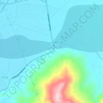
Name: Panan topographic map, elevation, terrain.

Location: Panan, Zambales, Central Luzon, 2202, Philippines (15.24083 120.01630 15.28083 120.05630)

Average elevation: 60 m

Minimum elevation: -1 m

Maximum elevation: 384 m

Gear up for your next adventure:

🚲Handlebar Phone Mount - View topographic-map.com live while cycling
🥾Hiking Shorts - Breathable shorts suitable for summer hikes
🎒Fully Waterproof Backpack - Total protection for photography gear and electronics
🛌Insulated Sleeping Pad - Critical thermal barrier between you and the cold ground
🧢Beanie Hat - Keep your head warm in cold weather

As an Amazon Associate, this site earns from qualifying purchases at no extra cost to you.