Geolocate

Tamarindo topographic map

Click on the map to display elevation.

About this map

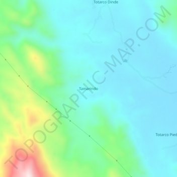
Name: Tamarindo topographic map, elevation, terrain.

Location: Tamarindo, Coyaima, Sur, Tolima, Colombia (3.68410 -75.21378 3.72410 -75.17378)

Average elevation: 489 m

Minimum elevation: 380 m

Maximum elevation: 882 m

Gear up for your next adventure:

🧥Packable Rain Jacket - Breathable waterproof layer for unpredictable weather
🛶Canoe Life Vest - Safety vest for water sports
🥾Hiking Gaiters - Protect legs and shoes from mud, snow, and debris
🔋Emergency Crank Radio - Weather alerts and power without needing batteries
📷Outdoor Action Camera - Capture high-elevation views and rugged adventures

As an Amazon Associate, this site earns from qualifying purchases at no extra cost to you.