
Tunga topographic map
Interactive map
Click on the map to display elevation.
About this map
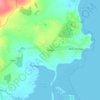
Name: Tunga topographic map, elevation, terrain.
Location: Tunga, Na h-Eileanan Siar, Schotland, HS2 0HJ, VK (58.22373 -6.36947 58.26373 -6.32947)
Average elevation: 15 m
Minimum elevation: -3 m
Maximum elevation: 80 m