Geolocate

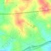
Creixell topographic map

Click on the map to display elevation.

About this map

Name: Creixell topographic map, elevation, terrain.

Location: Creixell, Tarragonés, Tarragona, Cataluña, 43539, España (41.15517 1.41078 41.21208 1.45951)

Average elevation: 86 m

Minimum elevation: 0 m

Maximum elevation: 315 m

Other topographic maps

Click on a map to view its topography, its elevation and its terrain.

Sant Simplici

España > Cataluña > Tarragonés > Tarragona

Average elevation: 41 m

Costa de la Toia

España > Cataluña > Tarragonés > la Secuita

Average elevation: 132 m

Ardenya

España > Cataluña > Tarragonés > la Riera de Gaià

Average elevation: 66 m

Gear up for your next adventure:

🥾Approach Shoes - Shoes designed for climbing approaches and rugged trails
🧭GPS Handheld Device - Reliable GPS navigation for outdoor adventures
🔦LED Headlamp - Hands-free lighting for early morning starts or late finishes
🧥Thermal Layer - Insulating layer for cold outdoor conditions
🧼Biodegradable Camp Soap - Environmentally friendly cleaning for gear and body

As an Amazon Associate, this site earns from qualifying purchases at no extra cost to you.