Geolocate

Retiro topographic map

Click on the map to display elevation.

About this map

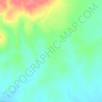
Name: Retiro topographic map, elevation, terrain.

Location: Retiro, Turbaná, Dique, Bolívar, Colombia (10.24012 -75.42863 10.26012 -75.40863)

Average elevation: 62 m

Minimum elevation: 32 m

Maximum elevation: 120 m

Gear up for your next adventure:

🍽️Titanium Camping Spork - Ultralight and indestructible eating utensil
🕯️Camping Lantern - Illuminates your entire campsite with high-efficiency LEDs
🥾Approach Boots - Comfortable boots for hiking and climbing approaches
🧢Outdoor Cap - Protective cap for sun and rain during hikes
💡LED Camping Lantern - Illuminate your campsite with long-lasting lanterns

As an Amazon Associate, this site earns from qualifying purchases at no extra cost to you.