
Thank you for supporting this site ❤️
Make a donation
Make a donation
Gear up for your next adventure:
As an Amazon Associate, this site earns from qualifying purchases at no extra cost to you.
Blenheim topographic map
Click on the map to display elevation.
Thank you for supporting this site ❤️
Make a donation
Make a donation
Gear up for your next adventure:
As an Amazon Associate, this site earns from qualifying purchases at no extra cost to you.
About this map
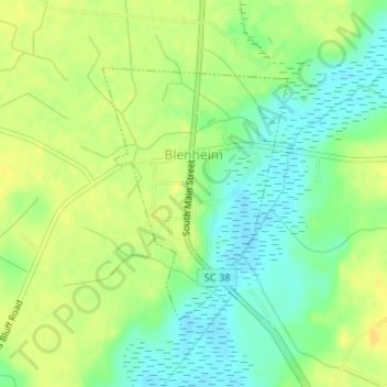
Name: Blenheim topographic map, elevation, terrain.
Location: Blenheim, Marlboro County, South Carolina, United States (34.49905 -79.66057 34.51667 -79.64487)
Average elevation: 36 m
Minimum elevation: 22 m
Maximum elevation: 48 m
Thank you for supporting this site ❤️
Make a donation
Make a donation
Gear up for your next adventure:
As an Amazon Associate, this site earns from qualifying purchases at no extra cost to you.
Other topographic maps
Click on a map to view its topography, its elevation and its terrain.
Country Club Heights
United States > South Carolina > Marlboro County > Bennettsville
Average elevation: 50 m