Geolocate

Rostock topographic map

Click on the map to display elevation.

About this map
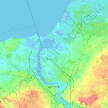
Name: Rostock topographic map, elevation, terrain.

Location: Rostock, Mecklenburg-Vorpommern, Germany (54.05081 11.99837 54.24450 12.29540)

Average elevation: 14 m

Minimum elevation: -4 m

Maximum elevation: 69 m

Gear up for your next adventure:

🧦Merino Wool Socks - Moisture-wicking comfort for long-distance hiking
🧴Waterproofing Spray - Restore the DWR coating on jackets and tents
🥾Trekking Poles - Adjustable trekking poles to reduce knee stress and improve stability
🔋Lithium AA Batteries - Long-lasting power that performs in extreme cold
🥽Outdoor Goggles - Protective eyewear for outdoor activities

As an Amazon Associate, this site earns from qualifying purchases at no extra cost to you.