Geolocate

Juf topographic map

Click on the map to display elevation.

About this map

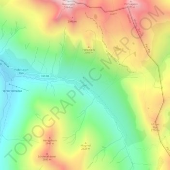
Name: Juf topographic map, elevation, terrain.

Location: Juf, Avers, Viamala, Grisons, 7448, Switzerland (46.42546 9.55970 46.46546 9.59970)

Average elevation: 2,469 m

Minimum elevation: 1,978 m

Maximum elevation: 3,148 m

Gear up for your next adventure:

🥾Mountain Hiking Shoes - Shoes with superior grip for mountainous terrain
🧭Orienteering Kit - Tools for map reading and navigation in the wild
📷Outdoor Action Camera - Capture high-elevation views and rugged adventures
🥾Hiking Gaiters - Protect legs and shoes from mud, snow, and debris
🥫Freeze-Dried Meals - Lightweight, high-calorie nutrition for multi-day treks

As an Amazon Associate, this site earns from qualifying purchases at no extra cost to you.