
Masinagudi topographic map
Interactive map
Click on the map to display elevation.
About this map
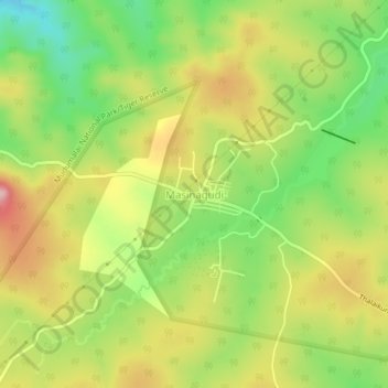
Name: Masinagudi topographic map, elevation, terrain.
Average elevation: 944 m
Minimum elevation: 847 m
Maximum elevation: 1,050 m
Other topographic maps
Click on a map to view its topography, its elevation and its terrain.
Udhagamandalam
Inde > Tamil Nadu > Udhagamandalam
Udhagamandalam, The Nilgiris District, Tamil Nadu, 643001, Inde
Average elevation: 2,234 m