
Make a donation
Gear up for your next adventure:
As an Amazon Associate, this site earns from qualifying purchases at no extra cost to you.
Eemland topographic map
Click on the map to display elevation.
Make a donation
Gear up for your next adventure:
As an Amazon Associate, this site earns from qualifying purchases at no extra cost to you.
About this map
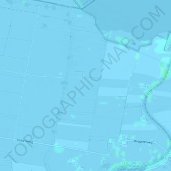
Name: Eemland topographic map, elevation, terrain.
Location: Eemland, Eemnes, Utrecht, Nederland, 3755 PL, Nederland (52.25523 5.29674 52.27523 5.31674)
Average elevation: -1 m
Minimum elevation: -3 m
Maximum elevation: 3 m
Make a donation
Gear up for your next adventure:
As an Amazon Associate, this site earns from qualifying purchases at no extra cost to you.
Other topographic maps
Click on a map to view its topography, its elevation and its terrain.
Eemnes
In de Middeleeuwen was de monding van de Eem een moerassig gebied dat meestal onder water stond. Na de Allerheiligenvloed van 1170 daalde echter het waterpeil in het drassige gebied rond de Eemmond. Daardoor kon ontginning van het gebied plaatsvinden en ontstonden het dorp Ter Eem en Huis Ter Eem. De…
Average elevation: 1 m
Eemnes
In de middeleeuwen was de monding van de Eem een moerassig gebied dat meestal onder water stond. Na de Allerheiligenvloed van 1170 daalde echter het waterpeil in het drassige gebied rond de Eemmond. Daardoor kon ontginning van het gebied plaatsvinden en ontstonden het dorp Ter Eem en Huis Ter Eem. De…
Average elevation: 1 m