
Isla Riesco topographic map
Click on the map to display elevation.
About this map
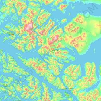
Name: Isla Riesco topographic map, elevation, terrain.
Average elevation: 218 m
Minimum elevation: -2 m
Maximum elevation: 1,645 m
Other topographic maps
Click on a map to view its topography, its elevation and its terrain.
Zona Austral
Chile > Region of Magallanes and Chilean Antarctica > Provincia de Última Esperanza > Puerto Natales
In the far south (Chile Austral), which extends from Valdivia through the Chacao Channel to Cape Horn, the Andes and the South Pacific meet. This district of the country is mountainous, heavily forested and inhospitable. The deeply indented coastline is filled with islands which preserve the general outline of…
Average elevation: 768 m
Cape Horn
Chile > Region of Magallanes and Chilean Antarctica > Provincia de la Antártica Chilena > Cape Horn
Average elevation: 49 m