Geolocate

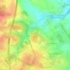
Brandet topographic map

Click on the map to display elevation.

About this map

Name: Brandet topographic map, elevation, terrain.

Location: Brandet, Saintes, Charente-Maritime, Nouvelle-Aquitaine, France métropolitaine, 17100, France (45.70675 -0.68798 45.74675 -0.64798)

Average elevation: 44 m

Minimum elevation: 7 m

Maximum elevation: 83 m

Other topographic maps

Click on a map to view its topography, its elevation and its terrain.
Gear up for your next adventure:

🥾Mountain Trail Shoes - High-traction shoes for mountain trails
🧥Packable Rain Jacket - Breathable waterproof layer for unpredictable weather
🩹Moleskin Blister Pads - Direct protection for painful foot pressure points
🧢Sun Protection Cap - Breathable cap to protect from sun exposure
🔭Compact Monocular - One-handed bird watching and trail spotting

As an Amazon Associate, this site earns from qualifying purchases at no extra cost to you.