Geolocate

Melborne topographic map

Click on the map to display elevation.

About this map

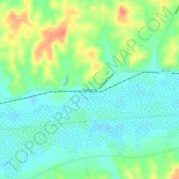
Name: Melborne topographic map, elevation, terrain.

Location: Melborne, Lamar County, Alabama, United States (33.55289 -88.22281 33.59289 -88.18281)

Average elevation: 83 m

Minimum elevation: 63 m

Maximum elevation: 122 m

Other topographic maps

Click on a map to view its topography, its elevation and its terrain.

Vernon

United States > Alabama > Lamar County

Average elevation: 105 m

Gear up for your next adventure:

🎒Hiking Backpack - Lightweight and ergonomic backpacks for day hikes or multi-day treks
💡LED Camping Lantern - Illuminate your campsite with long-lasting lanterns
💧Reusable Water Bottle - Durable water bottles for hydration on trails
🧼Biodegradable Camp Soap - Environmentally friendly cleaning for gear and body
🧊Insulated Water Bottle - Keeps drinks cold in summer and prevents freezing in winter

As an Amazon Associate, this site earns from qualifying purchases at no extra cost to you.