Geolocate

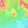
Baracs topographic map

Click on the map to display elevation.

About this map

Name: Baracs topographic map, elevation, terrain.

Location: Baracs, Dunaújvárosi járás, Fejér, Central Transdanubia, Transdanubia, Hungary (46.85501 18.81357 46.95112 18.93431)

Average elevation: 122 m

Minimum elevation: 90 m

Maximum elevation: 169 m

Other topographic maps

Click on a map to view its topography, its elevation and its terrain.

Székesfehérvár

Hungary > Fejér > Székesfehérvár

Average elevation: 150 m

Bucka

Hungary > Fejér > Csákberény

Average elevation: 222 m

Gear up for your next adventure:

🥾Waterproof Trail Shoes - Shoes designed to handle wet terrain
🧥Softshell Jacket - Windproof and breathable jacket for hiking
🔪Outdoor Multitool - Versatile tool for repairs and food prep in the wild
🔋Lithium AA Batteries - Long-lasting power that performs in extreme cold
🥾Lightweight Hiking Shoes - Comfortable shoes for day hikes

As an Amazon Associate, this site earns from qualifying purchases at no extra cost to you.